
Part of our series of posts by final-year undergraduate students for their Research Comprehension module. Students write blogs inspired by guest lecturers in our Evolutionary Biology and Ecology seminar series in the School of Natural Sciences.
This week, views from Sharon Matthews and Sinead Barrett on Nathalie Pettorelli’s seminar, “Monitoring biodiversity from space: a wealth of opportunities”.
Space, the final frontier for ecology?
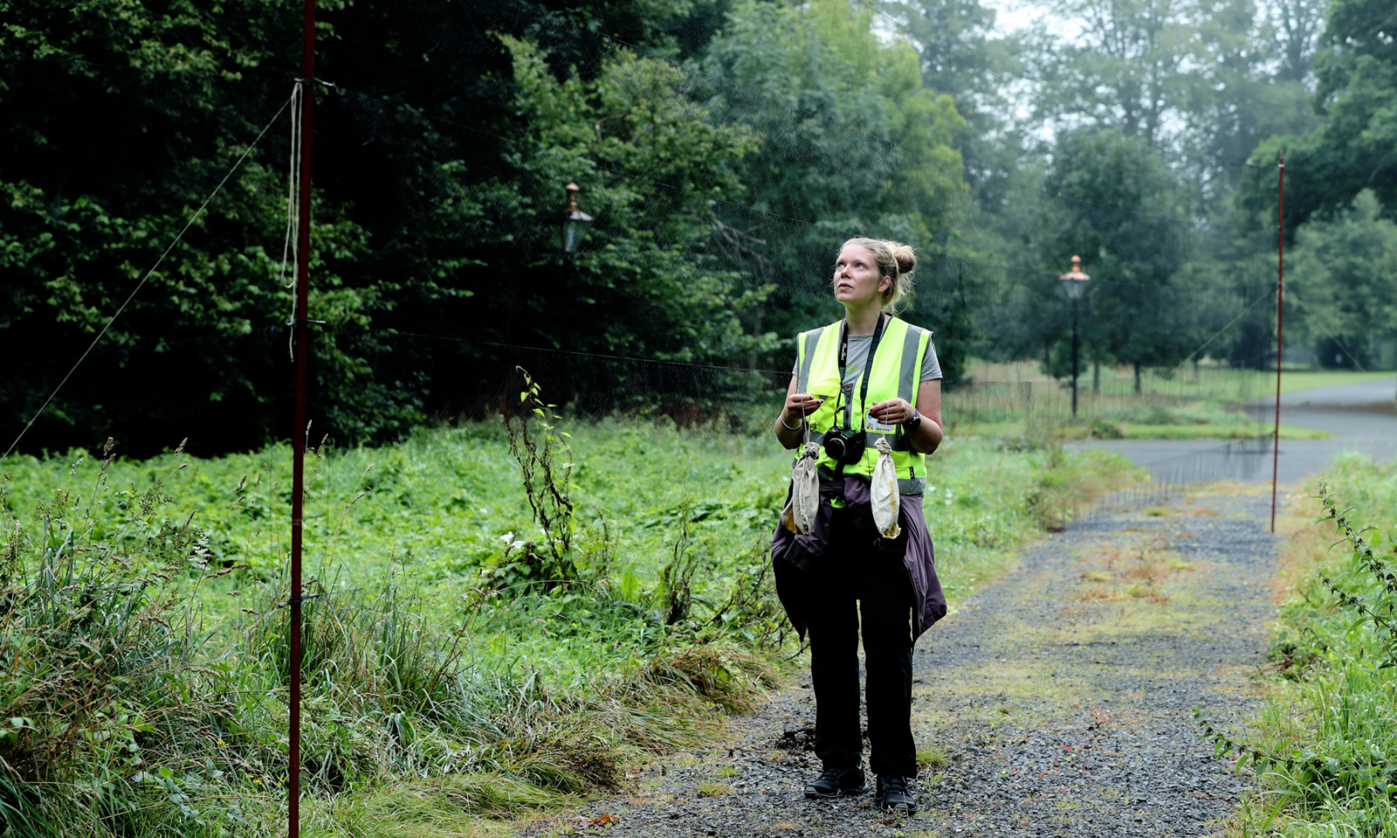
Okay, you got me. I am a trekkie who is fanatical about anything space related. So when I saw that this week’s seminar was to do with conservation biology from space, I was hooked! Dr. Nathalie Pettorelli from the Institute of Zoology, London spoke with passion and enthusiasm about a new wave of ecology; monitoring species and ecosystems from space.
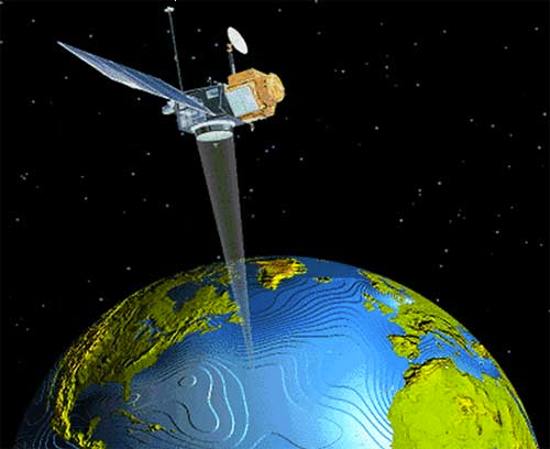
We were treated to information about remote sensing and how data from satellites can be used to help ecologists in the tasks of assessing population size and habitat condition. Earth observation (EO) data is free and is ripe for the picking. Satellites are able to “boldy go where no one has gone before” or very few people have (sorry, I will stop with the star trek quotes now!). They can get information on places that are often inaccessible and inhospitable for the lowly researcher like Antarctica and the Sahara desert.
One of the major tasks ecologists face is estimating the size of a population. Dr. Pettorelli talked about an ingenious research project that used information from satellites to gain an estimate of the population of emperor penguins (Aptenodytes fosteri) in Antarctica. Emperor penguin populations may be affected by climate change in the next few decades due to changes in sea-ice distribution and therefore it is important to get an estimate of the extant population.
Frettwell et al. (2012) examined quick-looks from three different very high-resolution satellites. These have a resolution of ~ 10m and are able to show great detail. The researchers looked for staining on images and classified it as snow, penguin, shadow or guano. When areas with penguins were identified, they analysed the penguin pixel area through regression equations. The statistics gathered from this were used to convert the area of penguins to population numbers.
In this study, the identification of a penguin from a pixel area was done by human interpretation and this led to some error especially in areas of high guano staining. This could be resolved with future development of higher resolution satellites. However, there were other issues that arose from using this technology. Researchers identifying penguins from pixels made an assumption that a pixel constituted one individual when it may in fact have been an individual with a chick close to it. This can affect the estimated population size. The kind of error association with using satellites makes me think that this satellite approach should be backed up with other methods such as field study where possible.
Remote sensing can allow research to be undertaken over a broad spatial and temporal scale. One of Dr. Pettorelli’s projects involved using EO data to assess a game reserve in central Chad for its ability to sustain a reintroduction of the Scimitar-horned Oryx (Oryx dammah). A vegetation index (an indication of ‘greeness’) and annual mean precipitation, were assessed over a 27-year period for this game reserve. The results showed that precipitation was a main driver of vegetation dynamics and there was an intense greening in the south of the region. Dr. Pettorelli also found that there was a contraction of the transition zone from north to south. This was an area that was identified as most suitable for the oryx. This study showed how remote sensing can help inform ecologists about variation in a region over time. It can greatly enhance the success of reintroducing a species into a suitable area.
There is no doubt in my mind that data from remote sensing can help ecologists in their work but I don’t think it should be used in isolation. Ecosystems involve a complex mix of interactions of many variables. Therefore, this approach could be used alongside other tried and tested (down to earth) methods of studying ecosystems and biodiversity.
Author: Sharon Matthews
——————————————————-
Evidence of Global Change is Sky High
As we all know, climate change is affecting the world in which we live. One aim of scientists is to find out the extent of this change. At a seminar given recently in Trinity College Dublin, Dr. Nathalie Pettorelli from the Zoological Society of London informed us about a new method of doing this. With benefits including the cost, its sustainability, reproductivity and standardised information, satellite usage as a way to monitor biodiversity seems like an excellent option.
Dr. Pettorelli mentioned the vast array of options of satellites available for monitoring depending on what you want to find out in the study. For example, very high resolution imagery has been used in order to count penguins in colonies, Landsat has been used to study the gorilla habitat in Virunga and LiDAR satellites which give a 3-D image have been used in the Bavarian forest. But what interested me most was when Dr. Pettorelli mentioned the ability to monitor vegetation indices and how this technique was used in the reintroduction process of the Scimitar-horned Oryx in Ouadi Rimé-Ouadi Achim Game Reserve in central Chad.
The Scimitar-horned Oryx was last found in the wild in the 1970’s. However it has been kept in captivity and there were plans of reintroducing it back into this area in central Chad. In order to do so, a habitat assessment was undertaken to establish whether the area would still be suitable for the species to live in. The primary productivity over the past number of years was viewed using remote sensing (satellite) techniques. It was seen that the vegetation in the north had significantly dried while the area to the south showed intense greening. Because the Oryx lives preferably in sub desert regions, suitable habitat here was declining and it was not advised to reintroduce this animal to the area.
To me, this shows just how important this method of monitoring is. Due to the increased changes that come about as a result of climate change, species are no longer suited to their natural habitat. Although it wasn’t mentioned in detail in the seminar, it struck me that one use of this satellite method of monitoring would be to use it in assisted migration. This is a method of conservation that involves humans undertaking a translocation of an animal or plant species. This is used when a species can no longer survive in their habitat and so must be moved to a more suitable area. This method of conservation is debatable as there are many associated risks involved including the impact on original species in the new habitat. However, with scientists doing research on this to study possible effects, it may save a species from dying out. Suitable habitat needs to be found for assisted migration to work. The methods that Dr. Pettorelli uses in her habitat assessment in central Chad could be the ideal way to find these habitats needed. This highlights the need for this new method of data collection. Because it is done at such a big scale, it seems like an excellent way of finding large habitats suitable for a new species, whether it’s a tree or a large carnivore.
Changes are occurring globally as a result of anthropogenic actions, and species worldwide are dying out as a result of this. It is clear from the numerous examples mentioned at the seminar that there are many uses of satellite imagery in monitoring biodiversity worldwide. After hearing Dr. Pettorelli talk about this subject, I left realising just how important technology such as satellites are in a time when global change is sky high.
Author: Sinead Barrett